Detailed Notes
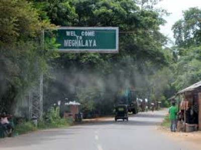
Assam shares boundaries with seven northeastern states, along with Bhutan and Bangladesh, earning it the reputation of being the gateway to Northeast India. Among all neighboring states, Meghalaya has the longest shared boundary with Assam, followed by Arunachal Pradesh.
The eight Assam districts touching Meghalaya are:
-
South Salmara-Mankachar : Primarily around the Mankachar town area, Thakuranbari village, and Halidayganj, connecting via roads through Tura
-
Goalpara : Primarily along the East Garo Hills, with key border-adjacent areas including Nisangram, Hohua (near Dhupdhara), and Damra. This scenic, hilly boundary features waterfalls, rural Garo villages, and riverside spots like the Hohua River.
-
Kamrup : Primarily Langpih village, Ukiam, Hahim, Borduar, and Boko areas, often extending near the Kulsi river. These areas are central to ongoing inter-state boundary disputes.
-
Kamrup Metropolitan : Primarily connecting with the Ri Bhoi district, with key contention points including Khanapara-Pilangkata and Borkhampani.
-
Morigaon : Shares its southern boundary with Meghalaya
-
West Karbi Anglong : Primarily defined by areas like Block I & II, Khanduli, Psiar, Tapat, and the Umler River. Key border localities also include Sabuda village, Umswai Valley, and Koka.
-
Dima Hasao : Primary place where the Dima Hasao district of Assam borders Meghalaya is around Umrangso, an industrial town and hill tract famous for its artificial lake and power projects.
-
Cachar : Primarily east/northeast, specifically along the Barail and Jaintia Hills ranges, connecting via hilly terrain. While major 12-sector disputes exist elsewhere, this mountainous junction marks their intersection, separating the plains of Cachar from the Jaintia Hills.
These districts stretch across western, central, and southern Assam, highlighting the wide geographical spread of the Assam-Meghalaya border.
Despite strong inter-state connections, there are also 12 identified border dispute areas, commonly referred to as areas of difference, with major issues reported in locations such as Langpih. These disputes remain important topics in Assam-Meghalaya administrative and political discussions.
Main Highlights
-
Total Assam districts bordering Meghalaya: Eight
-
Border length: Approximately 885 km
-
Major bordering districts: Kamrup, Goalpara, Dima Hasao, Cachar
-
Total northeastern states bordering Assam: Seven
-
Border dispute points: Twelve identified areas, including Langpih