
About Baksa District
Baksa district is one of the 27 districts of Assam which is a result of historic BTC(Bodoland Territorial Council) accord signed on February 10, 2003, formed BTAD(Bodoland Territorial Autonomous District) with four districts namely Kokrajhar, Chirang, Baksa and Udalguri. Baksa is dominated by tribal community. Mushalpur town is the headquarters of the district. This district is bounded by Bhutan in the north, Udalguri district in the east, Barpeta, Nalbari and Kamrup districts in the south and Chirang district in the west. Area of the district is 2400 sq.km. The population of the district is 9,53,773(2011 census).
Origin of the Name - Baksa
Peoples says that the name "Bagsa" is originated from Bhutanese language. According to Bhutanese origin they denoted the area as "Bagsa Duar". "Bagsa" meaning one kind of rice and "Duar" meaning entrance point. As Bhutanese king ruled these areas for a long time in an around first half of the nineteenth century so it might be possible that the name "Bagsa" or "Baksa" had a Bhutanese origin. According to Bodo source the name originated from a kind of rice grain which is known as "Bagsa". The said rice grain is one kind of broken and uncleaned product which is gained after milling the rice.
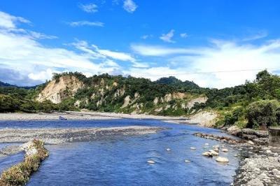
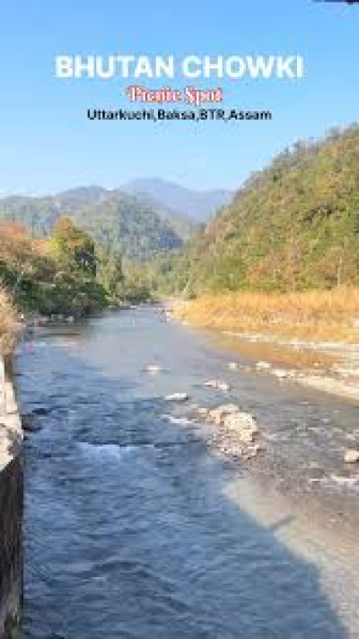
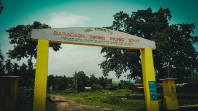
Tourist Attractions in Baksa
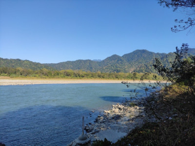
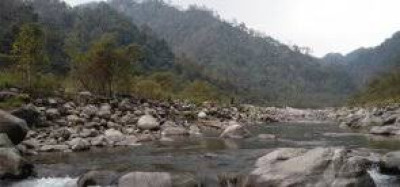
Manas National Park: Distance from District HQ - 45KmKokilabari: Distance from District HQ - 70Km
Moina Pukhuri: Distance from District HQ - 65Km
Bhangtar: Distance from District HQ - 75Km
Bogamati: Distance from District HQ - 90Km
Major Tribes in Baksa District : Boro, Rabha, Sarania Kachari, Madahi
Educational Institutions in Baksa District
. Barama College
. Goreswar College
. BB Kishan College, Jalah
. Tamulpur Jr. Commerce College
. Salbari Jr. College
. Nikasi Jr. College
. Dhamdhama Jr. College
Banks In Baksa District :
1) Central Bank Of India,B/O. NAYABASTI, VILLAGE & P.O. DHAMDHAMA, Pincode: 781342, Phone (03624) 233097.
2) Central Bank Of India, P.O. MAHARIPARA, Pincode: 781364
3) Central Bank Of India, VILL. NO. 1, NATHKUCHI, P.O. NATHKUCHI VIA TIHU, Pincode: 781371.
4) State Bank Of India (SBI) - KADAMTAL ROAD, MUSHALPUR,Phone : 03627-234676
Banks ATMs In Baksa District :
1) STATE BANK OF INDIA ATM, MUSHALPUR
Baksa District Tourism Quick Info Table :
| Category | Details |
|---|---|
| District Name | Baksa District, Assam |
| Headquarters | Mushalpur |
| Region | Bodoland Territorial Region (BTR) |
| Formation Year | 2003 (After BTC Accord) |
| Total Area | 2400 sq. km |
| Population (2011) | 9,53,773 |
| Main Languages Spoken | Bodo, Assamese, Hindi, English |
| Major Tribes | Boro, Rabha, Sarania Kachari, Madahi |
| Best Time to Visit | November to April (pleasant weather for wildlife and sightseeing) |
| Nearest Airport | Lokpriya Gopinath Bordoloi International Airport, Guwahati (Approx. 125 km) |
| Nearest Railway Station | Rangiya Junction (Approx. 65 km) |
| Nearest National Park | Manas National Park (45 km from Mushalpur) |
| Major Tourist Attractions | Manas National Park, Kokilabari, Moina Phukhuri, Bhangtar, Bagamati |
| Local Festivals | Bwisagu Festival, Domashi, Magh Bihu, Bohag Bihu |
| Major Colleges | Barama College, Goreswar College, BB Kishan College |
| Main Banks | State Bank of India, Central Bank of India |
| PIN Codes | 781372, 781373, 781364 (varies by area) |
| Average Elevation | 80–120 meters above sea level |
| Nearby Districts | Udalguri, Chirang, Barpeta, Nalbari, Kamrup |
| Official Website (if any) | https://baksa.assam.gov.in/ |
Frequently Asked Questions on Baksa District (with short answers)
Q1. Where is Baksa district located in Assam?
Baksa district lies in western Assam, under the Bodoland Territorial Region (BTR), with Mushalpur as its headquarters.
Q2. When was Baksa district formed?
Baksa district was created after the BTC Accord on February 10, 2003.
Q3. What is Baksa district famous for?
Baksa is known for its tribal culture and its proximity to Manas National Park, a UNESCO World Heritage Site.
Q4. What is the population of Baksa district?
As per the 2011 Census, Baksa district has a population of about 9.53 lakh.
Q5. Which are the main tribes in Baksa?
The major tribes are Boro, Rabha, Sarania Kachari, and Madahi.
Q6. What is the origin of the name Baksa?
The name Baksa likely comes from the Bhutanese term “Bagsa Duar,” meaning “gateway of rice.”
Q7. What are the top tourist places in Baksa district?
Popular spots include Manas National Park, Kokilabari, Moina Phukhuri, Bhangtar, and Bagamati.
Q8. Which are the main colleges in Baksa district?
Barama College, Goreswar College, and B.B. Kishan College are among the top institutions.
Q9. What are the nearby districts of Baksa?
Baksa shares borders with Udalguri, Barpeta, Nalbari, Kamrup, and Chirang districts.
Q10. How far is Manas National Park from Baksa headquarters?
Manas National Park is around 45 km from Mushalpur, the district headquarters.