Introduction: Assam at an Environmental Tipping Point
Assam, shaped by the mighty Brahmaputra and Barak river systems and known for its forests and biodiversity, is confronting two interconnected environmental disasters: severe soil erosion and increasing forest fires. These crises are shrinking land, displacing communities, damaging biodiversity and destabilizing the state's fragile ecological balance.
While floods dominate headlines every monsoon, erosion and wildfires are steadily intensifying due to climate change, deforestation, poor infrastructure planning and human activity. Together, they form a dangerous cycle threatening Assam's geography, economy and social stability.
The Soil Erosion Crisis: Assam's Disappearing Land
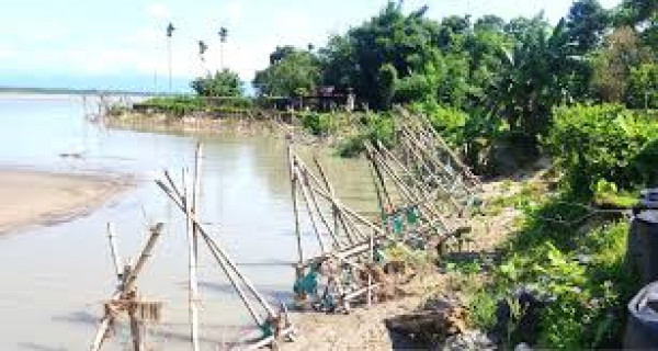
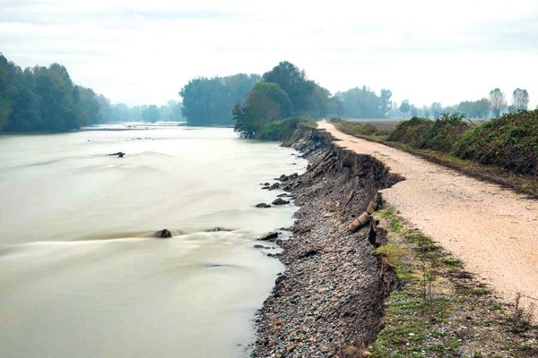
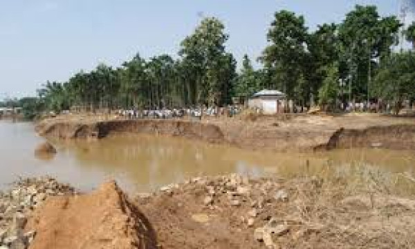
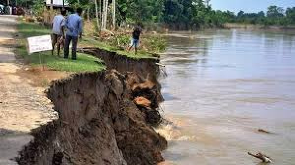
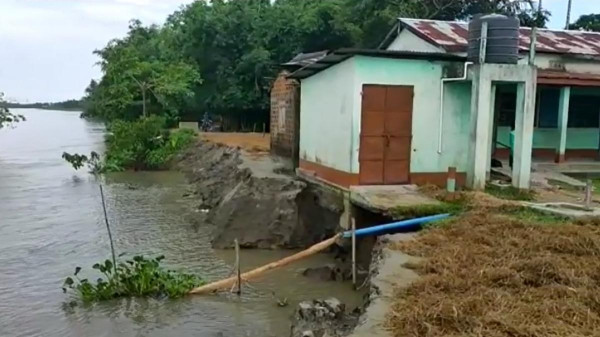
Assam experiences one of the highest rates of riverbank erosion in India. The Brahmaputra, Barak and their tributaries constantly alter their channels, devouring fertile land and settlements.
Alarming Data and Ground Reality
-
7.40% of Assam's total land area has been eroded since 1950.
-
Over 427,000 hectares of land have been lost.
-
39.58% of the state's total area is flood prone, compared to the national average of 10.2%.
-
Between 1954 and 2004 alone, 3,86,000 hectares were eroded at an average of 80 sq km per year.
-
90,700 families across 2,534 villages were severely affected during that period.
-
An investigation reported that 44,13,290 houses were destroyed in the last 65 years due to floods and erosion.
Districts such as Dhemaji, Dibrugarh, Barpeta and Dhubri remain highly vulnerable. Rohmoria near Dibrugarh has lost nearly 40 villages in five decades. In Baksa and Barpeta districts, entire villages have been partially or almost completely erased by rivers like Beki.
In Dhubri district, 228 government schools were reportedly washed away since 2012. These figures highlight the magnitude of permanent displacement caused by erosion.
Displacement: The Invisible Crisis
Flood displacement is often temporary. Erosion displacement is permanent. Families lose land forever.
Official figures record only those who enter relief camps. Many others take shelter along highways, embankments or with relatives. In July 2020 alone, nearly 49,000 people were in relief camps, while the actual number affected was far higher.
Between 2008 and 2019, an average of 3.6 million people were displaced annually in India, mostly due to flooding. In Assam, recurring flood-cum-erosion displacement has become normalized, but remains a serious policy failure.
Why Soil Erosion is Worsening
-
Braided River SystemThe Brahmaputra's dynamic, braided channels constantly shift course, widening riverbanks.
-
DeforestationLoss of vegetation weakens soil structure and increases runoff.
-
Faulty Embankment SystemAssam has 4,473.82 km of embankments, mostly built between 1954 and the 1980s. Regular breaches, locally called Mothawri Bhanga, show structural failure.
Draft policy documents have admitted that no long-term measures have been implemented to mitigate flood and erosion problems.
-
Encroachment of WetlandsUrban expansion over natural drainage systems increases flood intensity.
-
Climate ChangeErratic monsoons, concentrated rainfall and rising temperatures intensify river discharge and erosion.
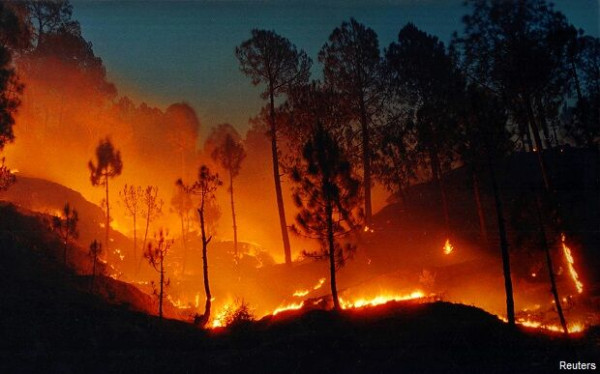
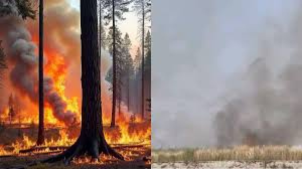
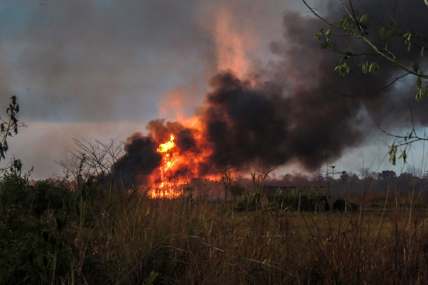
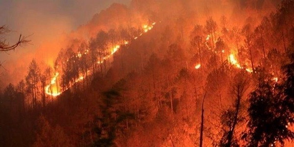
Forest Fires: The Silent Ecological Threat
While floods erode land, forest fires are burning away Assam's green cover, especially between February and May.
Rising Deforestation and Tree Cover Loss
Between 2001 and 2023, Assam recorded severe reduction in tree cover. Karbi Anglong and Dima Hasao account for over 62% of forest loss. Karbi Anglong alone lost 119 kha of forest.
Forests that once absorbed carbon and moderated temperatures are shrinking, contributing to extreme weather patterns.
Major Causes of Forest Fires
-
Shifting cultivation or Jhum practices
-
Prolonged dry spells due to climate variability
-
Rising temperatures
-
Poaching-related fires
-
Human negligence
Impact of Forest Fires
-
Destruction of wildlife habitats including corridors linked to Kaziranga
-
Increased PM2.5 and carbon emissions
-
Loss of soil fertility
-
Higher risk of future erosion
When forests burn, root systems disappear, leaving soil exposed to monsoon floods. This accelerates erosion.
The Climate Change Connection
The Climate Vulnerability Index 2021 ranks Assam as India's most climate-vulnerable state.
Climate change has manifested through:
-
Volatile and concentrated rainfall
-
Rising mean temperatures
-
Severe floods
-
Increasing landslides
-
Accelerated soil erosion
In 2022, Assam received double its average June rainfall within three weeks. Between 2016 and 2022, nearly 1,000 landslides caused over 100 deaths.
The Living Planet Report 2024 identifies wetlands loss, drought and flooding as critical tipping points, all of which affect Assam directly.
The Vicious Cycle: Erosion and Fires Feeding Each Other
Forest loss removes natural buffers against rainfall and wind. Exposed soil becomes vulnerable to flooding and erosion.
Erosion then destroys riverine forests, reducing biodiversity and increasing human-wildlife conflict.
This feedback loop accelerates ecological degradation.
Nature-Based Solutions: The Molai Kathoni Model
One of Assam's most inspiring ecological models is Molai Kathoni forest on Majuli island, created by Padma Shri awardee Jadav Payeng.
Over 39 years, a mixed-species plantation on degraded sandbars restored biodiversity comparable to natural forests. Dominant species include:
-
Bombax ceiba
-
Dalbergia sissoo
-
Samanea saman
-
Tetrameles nodiflora
-
Gmelina arborea
The forest now hosts elephants, rhinos and tigers during floods.
Research shows that mixed plantations can:
-
Stabilize floodplains
-
Increase carbon stock
-
Conserve biodiversity
-
Reduce anthropogenic pressure
-
Provide livelihood opportunities
Majuli district has already raised 745 hectares of plantation across 33 sandbars.
Experts recommend combining engineering, bio-engineering and nature-based solutions to address erosion sustainably.
Policy Gaps and Governance Challenges
Despite the National Water Policy 2002 and 2012 advocating non-structural measures, Assam continues to rely heavily on embankments.
Key issues include:
-
Weak community engagement
-
Lack of decentralized risk mapping
-
Poor integration of climate and disaster policies
-
Limited climate financing frameworks
The Draft SDMP 2022-30 proposes private sector engagement, insurance mechanisms and CSR-based funding, but implementation remains critical.
Community-Based Adaptation
Local knowledge offers effective solutions:
-
Bamboo stilt houses by the Mising community
-
Community-led tree plantations
-
Agroforestry systems
Decentralizing climate planning to panchayats can empower vulnerable communities.
Conclusion: Time for Structural Change
Assam's land is shrinking and its forests are burning. Soil erosion and forest fires are not seasonal events but structural environmental crises.
Without urgent scientific planning, climate adaptation financing, nature-based restoration and genuine community participation, these disasters will intensify land conflicts, economic instability and biodiversity loss.
The choice is clear: continue reactive fire-fighting measures or adopt long-term, ecosystem-based solutions that protect Assam's rivers, forests and people.
The future of Assam's geography depends on decisions taken today.